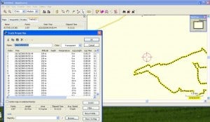
Ascent and Everytrail
After my post bemoaning the fact that the only way I had of importing trails from the Garmin Legend HCx on the iMac was through using Parallels and the Garmin software (PC only!).
Euan pointed me in the direction of Ascent for the iMac which can take in data from the Garmin and is Mac based software. Works beautifully and very fast! However, for some weird reason Everytrail wouldn’t display the track, even though it was visible in Google Earth.
Great news from Chris at Everytrail is that he has found and fixed the bug (VRM in action) so now Ascent will display the trail in Everytrail with the photos, geotagged by Houdah, and downloaded from Flickr.
Here is an example of a walk that Sally, Ellee and I did with the Cambridge Ramblers C for codgers group last Wednesday a far cry from pounding the camino in Spain doing 25mile days in temperatures of 30 degrees. But an interesting day anyway 🙂
Stretham walk take2
Widget powered by EveryTrail: GPS Geotagging

