Inveterate dabbler in business, travel, gadgets & life

South West Coast Path 608 miles to go.
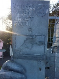
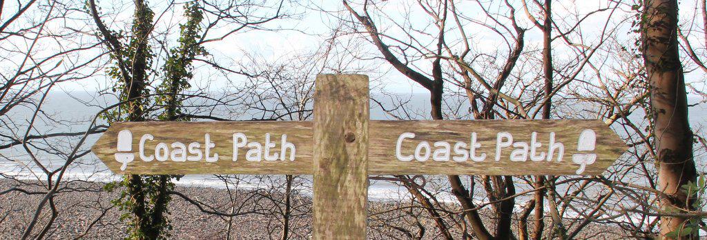
Coast path sign

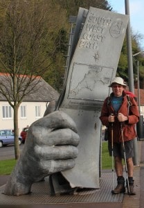
Geoff at start of South West Coast trailI had a corker of a day! I did the first two days of the South West Coast Path walk in one day including the additional strenuous bit. The  GPS gave the distance travelled as 22 miles. with a vertical ascent of over 6000 feet.

Started the day with a great breakfast at The Quay Inn of a kipper and two poached eggs 🙂 I spoke to another guy who was starting the walk today but he was slackpacking and only going the first 9 miles before his suitcase caught up with him.

With it being a fine, cold day and arriving at Porlock at 1 pm I decided to carry on and get to Lynmouth. It got pretty tiring towards the end as the hills are relatively short but much steeper than in The Pyrenees.

The biggest problem is the diabolical mobile phone coverage, the poor iPhone has been ¨searching¨all day 🙁 with very intermittent connections. In Lynmouth, my hotel The Bath Hotel (an apt name as my room has no shower but a huge long bath) has yet to hear about this internet thing. So I’m ensconced in The Rock House Hotel drinking Guinness and eating fish & chips to try and replace the 4500 calories that Fitbit things I’ve burnt walking the 49,000 steps and climbing up 441 floors).

The pics on Google+ can be found here

Here is my Everytrail of the day (Hopefully the pics will get there before the battery runs out).
Minehead to Lynmouth – South West Coast Path at EveryTrail
EveryTrail
 

Ready Steady Go

South West Coast Path starting sculptureAfter finalising my 10kg of packing it was a pleasant day of travelling on trains & a bus I arrived at Minehead in the late afternoon. I’m staying at The Quay Inn, enjoying it’s free WiFi. The South West Coast Way  starting sculpture is about 50 metres away and my room overlooks the sea, all very pleasant if somewhat expensive (£50 a night for b&b).

Preoccupations recommended Toucan Wholefoods so I stocked up on trail mix 🙂 & had a scone with tea.  Then of to Morrisons to stock up with sardines, tomatoes,  Mars bars, malt loaf, hot cross buns, bread baps & a banana, So should be OK for at least a couple of days 🙂

The T mobile 3G signal started to rapidly degrade after Newbury on the train. I had been listening to di.fm in perfect quality before that. Down here the signal is terrible and according to the coverage charts likely to get much worse 🙁 Whereas walking The Lycian Way in so called backward Turkey we had perfect 3G most of the way with TurkCell.

Before I set off I signed upto GiffGaff as O2 coverage seemed better. However, I just plugged the SIM in and I’m not allowed to tether the Air 🙁 selecting the option takes you to a 404 page not found on the O2 website). So it looks as though I will be restricted to private WiFi points.

Weather wise it’s looking OK nice & cold but sunny, at least for now. Breakfast is at 8am so I will be on my merry way to Porlock Weir (4.5 or 5.5 hours) or maybe even closer to Lynton (5.5 hours)


630 miles to go….

Tomorrow should see me venturing of to try and walk the 630 miles (1008Km) and apparently 114931 ft (35031 m) of vertical height on the South West Coast Path. So should be interesting especially in the foul weather at the moment.

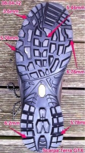
Scarpa GTX sole measurementsTo honour the occasion I’ve purchased yet another pair of Scarpa Terra GTX boots, about the 5th pair I reckon!. I’ve measured the Vibram soles (see the pic) and will take another picture upon my return!. My Fitbit is currently at 2,797,194 steps (Since 22 November 2011 if you are curious). My weight is now down to 78.2kg (12 st 4lb) so with the 10kg or so in my rucsac It will be my lightest walk yet 🙂

The biggest weight component in the rucsac is all the electronics! about 3,5kgm (7 lbs) including the EOS550D camera with zoom, 11″ Mac Air, Garmin Etrex GPS  & iPhone 4 with assorted batteries, chargers & my going away

present from Sally of these ultra smart USB leads from Apple.

No space for the tent & sleeping bag this time! Just taking a bivvy bag in case of dire emergencies.

For anyone who is interested you can follow all my internet activity for the past 4 years on Memolane 🙂


A day in the Cambridge snow

four inch of snow on tableAfter last night’s epic (by Cambridge standards) 4″ of snow. The Cambridge Rambling Club A group walk around Histon was cancelled so Sally & I met up with Jill at the usual starting place in Harvey Road and concocted our own walk up to Coton (where we bumped into the B group) then across to Grantchester for a scone and cuppa at The Orchard with a ramble back along the river to Cambridge.

A very pretty walk in the snow, although my legs found it quite tiring like walking along the beach. The most surprising part was that the Coton Footpath had been largely cleared of snow so was easy walking.

My Fitbit said I covered 15.4 miles burning 2700 calories the Etrex GPS made it 14.7 miles (3mph) so pretty close. I took quite a few pictures and also made a Everytrail of the walk here.

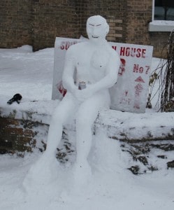
Snowman with can on a wall
Snowman on a wall

It was interesting to see the different types of snowmen that students had been making especially the latest trend of creating them sat down on park benches etc My favourite was this one on Elizabeth Way.

The day ended with one of Sally’s wonderfully relaxing hot stone massage 🙂 I tried to use my Zeo sleep measuring device to see how deep a sleep I go into, but it insisted I needed to plug the iPhone in 🙁 and lets face it when you are so relaxed can you be bothered….