 Another glorious autumnal day 🙂 The tyre stayed up after my latest attempt at fixing the puncture in the front tyre. I pedalled across to the main hotel for a full on breakfast. It’s going to be interesting to see how my weight has changed, once I get back home, from eating mega breakfasts, chocolate bars & huge evening dinners. With Fitbit & Moves saying I’m only burning 3,000 to 3,500 cals a day.
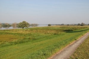
Having said that there were no open cafes for the first 40miles of today’s ride plus no Lidl to get chocolate bars. The ride on the right bank was delightful although the engineers couldn’t decide if you should be biking on top or bottom of the dykes so a bit tedious to climb up to discover no track on the top sometimes.
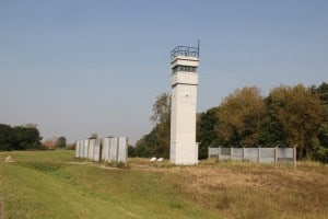
 Because the East bank of The Elbe was in the old East Germany there are still some of the watch towers and fencing that separated the Germans Interesting how Hamburg was carved out to be in The West with the border abruptly leaving The Elbe at Lauenberg to head over to Lubeck. So in fact I’ve been biking the Iron Curtain trail as well plus learning some history.
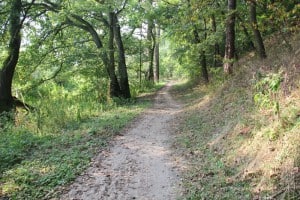
 Lauenburg is a totally fascinating place, once the border town, almost medieval alongside The Elbe with narrow cobbled streets and glimpses of the river. After the town the bikeway climbs steeply and heads through the woods. I got defeated by the steepness and loose sand so ended up pushing the bike up the hill 🙁 The poor bike was in agony as I crashed along very rough woodland tracks – a track more suited for suspension mountain bikes than a Dawes Galaxy Grand tourer!
The weather became decidedly threatening with the sound of thunder so once out of the woods in Geesthacht I dived into the first hotel – The very modern Elbblick where I was able to watch the rain & thunderstorm in comfort 🙂
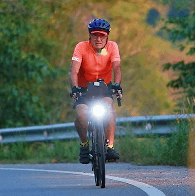
A great 65 miles of biking and 85% of The Elbe covered according to my spreadsheet, Here is the Strava and a few pics.
PS My friend Christopher has solved my sisters Groyne mystery: the effect of groynes on rivers: literature review
Groynes are structures constructed at an angle to the flow in order to deflect the flowing water away from critical zones. They are made of stone, gravel, rock, earth, or piles, beginning at the riverbank with a root and ending at the regulation line with a head. They serve to maintain a desirable channel for the purpose of flood control, improved navigation and erosion control.


Thanks for finding out. Interesting. I thought you had found a posh spa hotel.
Nope, I haven’t found one of those yet on this trip 🙁
I think you becoming obsessed with weight !
Just very interested, as it is one of easiest things to measure and changes an awful lot 🙂