Finding it difficult to take my body temperature tests twice a day, for the14 days I’m in quarantine, with the digital thermometer supplied by the ASQ Legacy Hotel in Bangkok. I thought I would work out some instructions. None were supplied and I have led such a sheltered life. I have never needed to take my body temperature in the past 74 years 🙂 So with a glass of warm water & Google, I started playing.
Thermometer supplied by The Legacy Hotel at Bangkok
Press the button once the display should show a temperature & battery level.
Press the button again the display should now go blank.
Insert the thermometer under the tongue at the back of the mouth.
Press the button for 60 seconds (actually, 7 seconds is enough in my tests with warm water).
Release the button and remove it from the mouth.
You should now have a temperature, Hopefully not above 37.5 degrees! The maximum tolerated by the Thai government.
Interestingly whilst in the UK to get the twin jabs I never once had my temperature taken whereas before I went here in Thailand every shop measures your temperature!
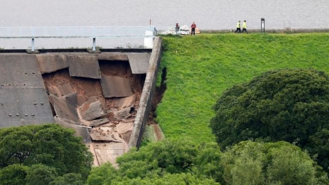
Interesting to find a couple of old reports on ‘freak weather’ in Whaley Bridge 147 years ago.
Whaley Bridge is mentioned twice in the flood chronologies for events in June 1872 and July 1881:
On 19th [June 1872] the Goyt was 12 to 14 feet above its normal level. At Whaley Bridge houses near the river were completely flooded and people were taken into the chapel and inns … in Macclesfield a woman and child were drowned when the river Bollin overflowed. Two reservoirs burst in the vicinity.
From: https://theconversation.com/heatwaves-and-flash-floods-yes-this-is-britains-new-normal-121351
The summer of 1872 was a wet and exceptionally thundery summer with frequent and at times severe thunderstorms.
Some reports of the thunderstorms that occurred during that summer.
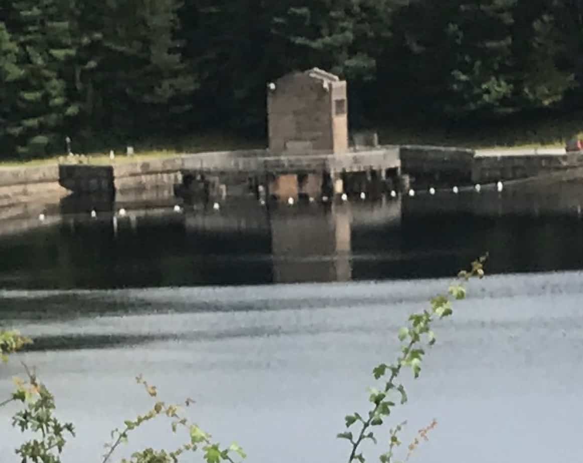
Still, we managed a quick ride from Buxton down The Goyt after a couple of very very wet days with the overflow at the Errwood Reservoir in full flow
Update 5 Aug 2019
December 1964
Toddbrook Incident date: December 1964 Construction details The reservoir was constructed in 1840-41 to supply water to the Peak Forest canal. It is on the north-west edge of the Peak District National Park near Whaley Bridge. The embankment is 24 m high with 1:2 upstream and downstream slopes. Further details of the dam construction are given in Incident No. 23. Incident description The water level was one metre above the spillway crest for a period of 24 hours following heavy rain and it took another two days for the level to fall to normal top water level. Damage was caused to the lower part of the spillway channel. Some parts of the side walls were washed out and some erosion took place on the right bank adjacent to the downstream toe of the dam.The main deterioration was caused by excessive flow down the spillway. Response The 1964 flood damage was repaired in 1965 and subsequent flood studies confirm the spillway was inadequate to take the design flood. An additional spillway was built in 1969 with a 75-m weir built over the southern section of the embankment discharging over a concrete-protected portion of the downstream face. The sill level is above the original spillweir level. Lessons The incident showed that despite the dam being in existence since 1840, the spillway was inadequate. The incident instigated a flood study of the reservoir resulting in an additional spillway constructed.
Charles, J Andrew; Tedd, Paul; Warren, Alan. “Delivering Benefits Through Evidence Lessons from Historical Dam Incidents”. environment-agency.gov.uk. Environment Agency. p. 140. Retrieved 1 August 2019.
CHARLES J A (1986). The significance of problems and remedial works at British earth dams.
Proceedings of BNCOLD/IWES Conference on Reservoirs 1986, Edinburgh
The 24-m high dam consists mainly of boulder clay with sands and
gravels. There is doubt about the existence of a puddle clay core even though it is shown on the original construction drawings. The dam is founded on fluvio-glacial sand and gravels, glacial till overlying a faulted sequence of mudstones, sandstones and shales of the Millstone Grit Series and Lower Coal Measures.
Incident history
The dam has a history of leakage. Since 1880, there were complaints about leakage into mine workings. In 1930 leakage was observed at the toe of the downstream slope. As a result of an investigation into the leakage, a depression was found on the upstream slope. This was investigated in 1931 and the area was then reinstated.
Incident description In November 1975 when the reservoir was low, a depression was noted in the same position on the upstream face as the 1931 depression. In Autumn 1977, 120 mm of subsidence was measured since 1975. The reservoir was emptied to inspect the full extent of the depression and revealed a crater approximately four metres across at the upstream toe partly in filled with silt and into which a tree appeared to have been sucked.
Investigations
Extensive investigation included boreholes, sampling and piezometers. Exploratory shafts were sunk on the upstream and downstream faces between 1978 and 1980. In 1981, a 1.2-m diameter masonry culvert was found beneath the dam, possibly for stream diversion during construction. Tracer tests showed this to have formed a leakage path through the dam.
Remedial works
In 1981, a compacted clay blanket was placed over the suspect area of the upstream toe and the bed of the reservoir. To solve the leakage problem, a single row grout curtain 60 m long within the clay core was formed using the tube-à-manchette system. The reservoir was refilled in December 1983.
Lessons
Until the reservoir was drawn down, the extent of the crater caused by erosion was unknown. The good practice of periodic inspection of the upstream face of a dam is illustrated by this incident.
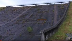
Spillway in 2016
Left is an interesting video from Miles Haslam showing the spillway in August 2016 with a small tree growing in it at the point that recently failed ! and on the right with a photo during the recent overflow showing the same tree 3 years later!
Following a previous comment on this blog from my friend and former wealth creator Pete. I decided to visit Coimbra the site of Portugals oldest university founded in 1290, Not Europes which is Bologna in Italy founded in 1088, btw Cambridge is 1209.
I decided, thankfully, to leave the bike in the hotel and take the train and walk around Coimbra. My Old man’s fare was €22 return. The train was an InterCity and interestingly had space to hang two conventional bikes at the end of each carriage we smoothly went along at 200kph so the trip only took just over 2 hours.
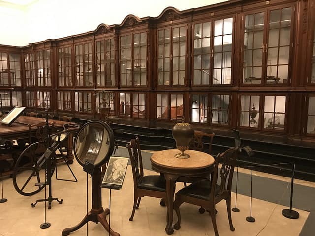
The university sits atop the hill so a fair climb up cobbled streets initially I wandered about the geological part of the museum looking at what I guess is their first geological map some 90 years younger than Smiths UK one.
I eventually found a formal tour around the science bits of the museum. It’s like a museum of a museum, everything is as it was labelled probably 100 odd years ago! Interesting in itself but no life in the exhibits at all. I just hope when the New New Cavendish gets built we will get a decent Physics Museum in Cambridge. Wouldn’t it be incredible to convert the original Cavendish back as it was with working replicas of the original stuff, pity they demolished the original DNA lab to make hideous bike racks.
The science then moved into Zoology with there collection of stuffed animals seemingly a focus on animals with two heads!
Later I did a little tour of the ornate Baroque Library I wonder when the last time a book left its shelves.
The town itself is a retail museum with shops out of the 1950’s full of counters with drawers and boxes with I thought way to much formal garb but incredible fruitcake in the cafe.
An interesting day out especially meeting Vasco on the train home who let me share his taxi from the station in the rainstorm back to the hotel.
Loads of photos here:
Loading Comments...
We use cookies to ensure that we give you the best experience on our website. If you continue to use this site we will assume that you are happy with it.